
Just in case you were wondering if you could get any livestock in Clarence Town...the answer would be yes! Of course, it says so on the sign.

The pounding surf, at hight tide, just in front of where we anchored in the reef protected cove of Clarence Town. When the tide was high, the current was super strong. The current was so strong that our swim ladders were nearly parallel with the waters surface.

There were 4 sailboats and Foxy Lady

The marina where we landed our dinghies....very friendly, helpful staff

Is this Deans Blue Hole?
How many cruisers does it take to find Dean's Blue Hole?? Ummmm, 4 adults, 2 dinghies and a rental car with 6 kids in tow. I was the one who suggested we skip the Crooked Islands and go straight to Long Island based on what I had seen on s/v Por Dos' website. The things they had seen and done looked so much more interesting than visiting some islands that we knew very little about (they were uninhabitated). Why not? When looking at the chart, we tried to locate Dean's Blue Hole but it wasn't labeled. However, there was a big, perfect circle on the chart very close to where we were anchored. That must be it? But why did it say it was only 30 feet deep? That's strange. Without thinking twice, without asking a single question, we set off in the dinghies across some shallow water to the 'big blue hole'. It looked so amazing to see super shallow, incredibly light blue water turn a deep blue instantly. That must be it. But wait, that couldn't have been it because it looked nothing like the photos in Por Dos' post. I suggested that we walk over to some more super shallow water around the bend and maybe it will be there. I went ahead and thought I had finally found Deans Blue Hole. Except that it wasn't very deep blue. It was more like a dark green, reminiscent of 20 feet in depth, not the 600 feet it was supposed to be. Erica donned her snorkel mask and set out to see if we could come to some sort of conclusion once and for all. Nope, that was definitely not it. Hmmmm, well it must be the big blue spot over there. So, we traipsed back to the other 'hole'. We all got our snorkel gear on and swam out to the middle. The water was so warm right at the edge but as soon as we swam into the deep blue, it felt 10 degrees colder...brrr. It must be way out there in the middle where the bouy is. We thought, of course, that's where they do the free dive courses. Wrong, again. It was 30 ft deep just like the chart said. We swam back to the dinghies, let the kids play on the beach while we scratched our heads trying to figure out where we went wrong.

Oh, there's the sign...clear as mud sitting on the ground with overgrown bushes in front of it.

And then we were met with this sign....what would you be thinking?

That's the real platform used for free diving classes (which we tried to arrange but the company had left for the season).
Ahhhh, finally. Deans Blue Hole. Now this is what I remember from the pictures! It looks inviting and mysterious. Its deep blue color is mesmerizing as you stare at the seemingly infinite depth. Deans Blue Hole is the worlds deepest known blue hole and the worlds second largest, water filled cavern body. We put on our snorkel gear and checked it out for ourselves. I was nervous. I don't know why. Perhaps I thought the blue hole would swallow me. It took me several tries to feel comfortable diving down to where the hole was located. It was clear as day. The sandy edge gently sloped 30 feet or so and then it just dropped, 660 feet! The hole itself was roughly 100 feet wide. We snorkeled around the perimeter, watching the fish and a group of baby sea horses. We also jumped from the rocks with no worries about hitting bottom!


The beautiful shallow waters right next to the blue hole

The ragged, weather worn rocks surround the blue hole

After all that searching, we were starved. We found Max's along the roadside and it looked like it had a lot of stories to tell.

Bahamian house behind Max's.


See what I mean...so much to look at. I ordered conch salad which was made fresh right there on the spot. I even got to test my batch to make sure it wasn't too spicy.

After lunch, we headed back to town. We stopped at Sts. Peter and Paul Catholic Church. This is one of two churches in town built by the same man.

View of Clarence Town and the anchorage from the top of the church turret. You can barely make out 5 little specs across the water. One of those is our boat.

Looking the other direction

Princesses awaiting their prince charming

Peek-a-Boo

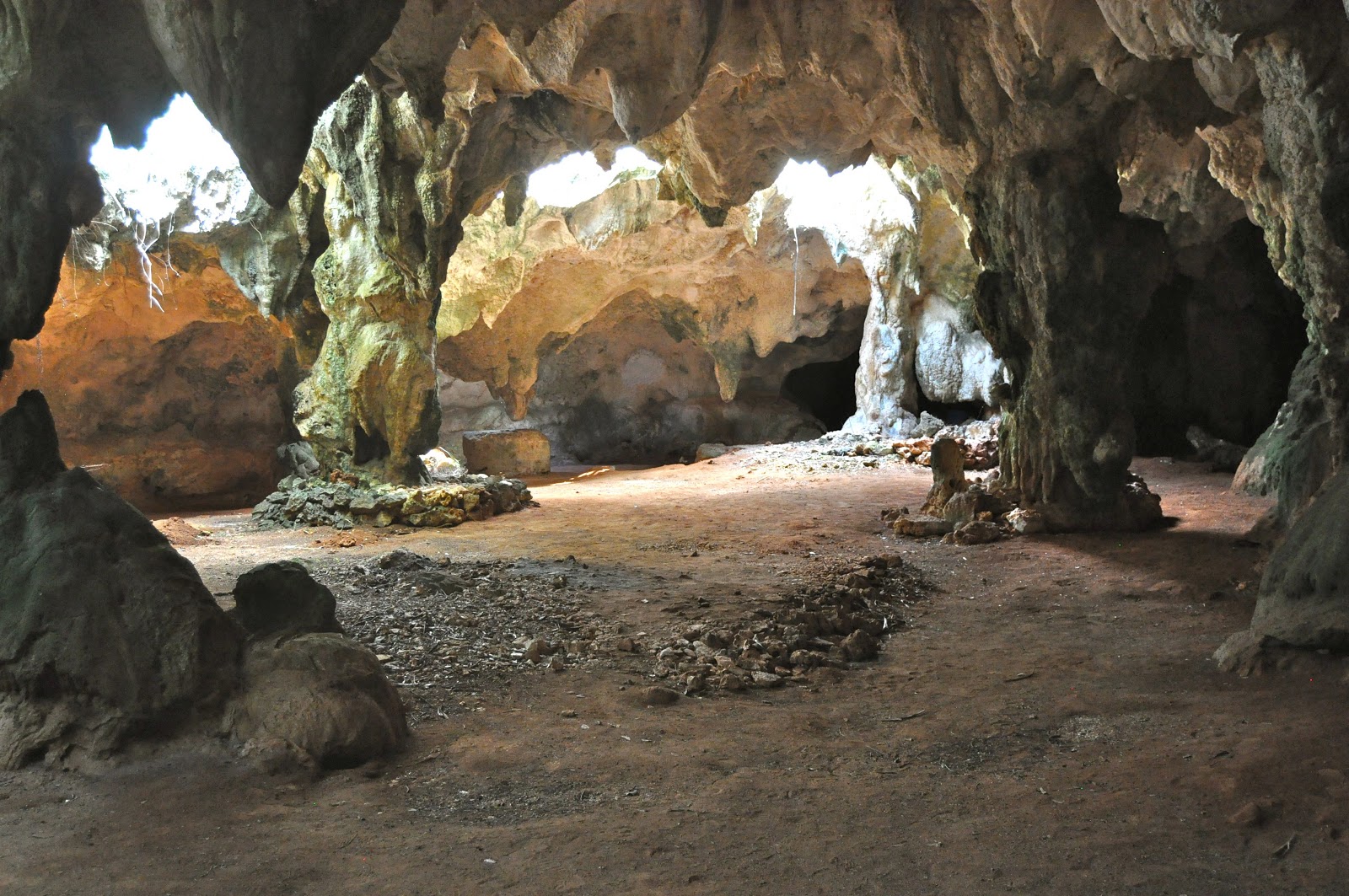
We had an appointment at 10 am the next day to tour Hamiltons Cave.

Entering the cave with our guide, Edward. His family owns the property in which these caves lie underground. They were once used by the Lucayan Indians as well as a hurricane shelter in more recent years.

Tree roots reaching for the ground from above the cave

Stalactites dripping from the limestone ceiling of the cave.

Stalagmites forming from the stalactites above
Columns form where stalactites and stalagmites meet

Another beautiful stalactite that has been forming for hundreds of years and is laden with crystals that sparkle in the flashlight beams.

Spies or cave dwellers?

One of the 5 species of bats that call the cave home. The bat droppings used to be shoveled out and used as fertilizer. Some people in our group, to be left nameless, did not like the bats!

One of the ancient sculptures carved into the limestone

Ancient carvings on the limestone walls

The whole gang
No comments:
Post a Comment